Final Route
The Ascent:
Parker Trail
Distance: 1.2 miles
Grade: Easy
Humans: 0
The hike up Parker was not difficult. Although the trail constantly gained elevation, the grade was slight. There were a fair amount of rocks and roots and several wet and muddy areas but it was easy to stay dry by rock hopping over the water. The mosquitoes were a bit of a nuisance but the Ben's 30% DEET I applied kept the little buggers swarming around my head at an acceptable distance.


Parker Trail marker

Poole Reservoir waterfall

Easy hiking

Cliff Walk Trail
Distance: 1.4 miles
Grade: Moderate
Humans: 1
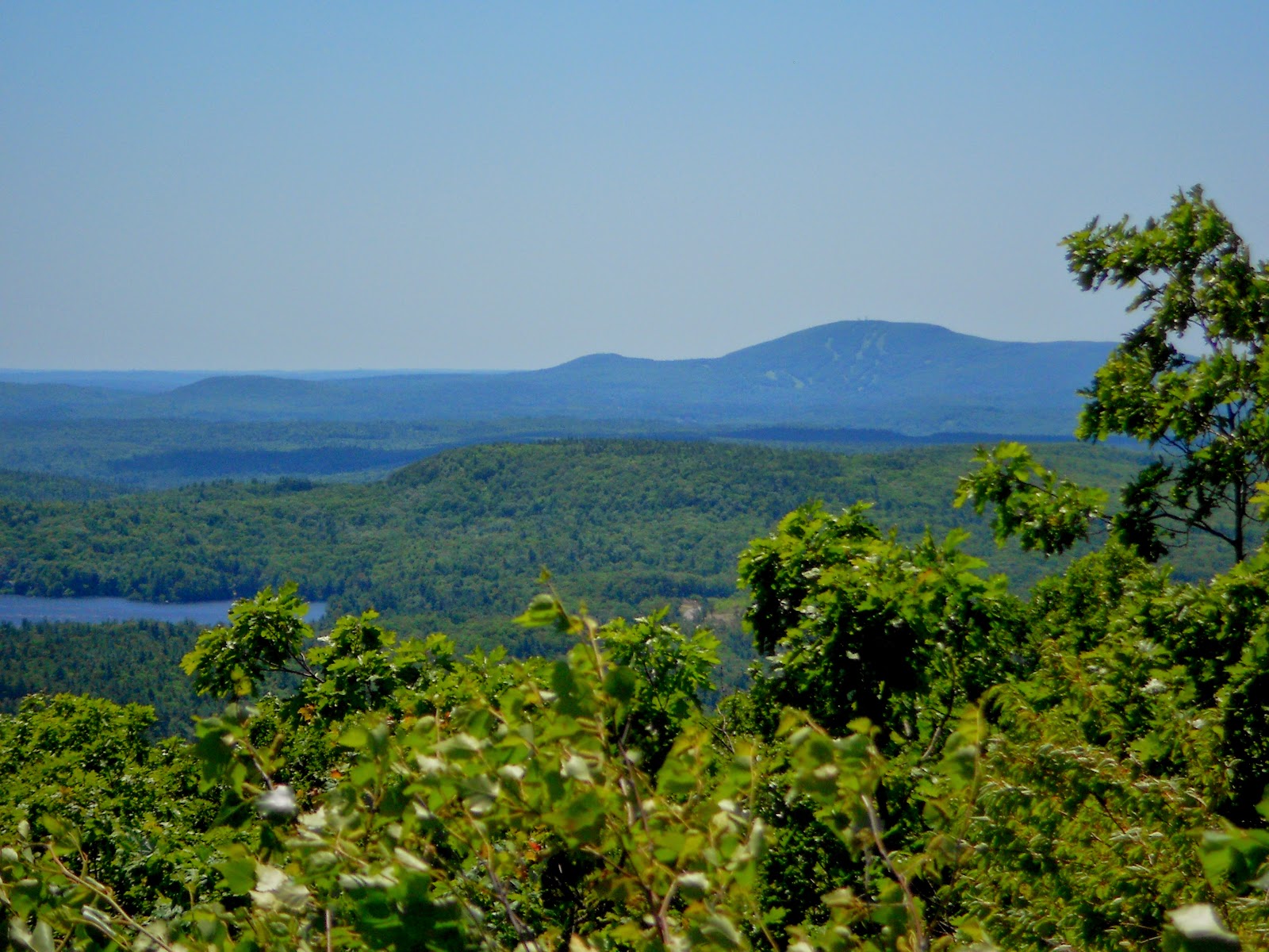
The grade changed immediately once I turned onto the Cliff Walk Trail. Most of climbs were moderately difficult but a few of them were steep and required a hard effort. I was surprised by the amount of ups and downs on the trail. I had expected to be climbing the entire way. Most of the trail was under tree cover but there were times when it opened up on a ledge and offered beautiful views of the countryside and mountains in the distance. This was my favorite trail on the hike.


Cliff Walk Trail marker

Very steep and difficult section

Straight up, latter required!

Nice view from Cliff Walk

I believe that is the Wapack range in the distance.


North Pack and Pack Monadnock?

View from Bald Rock

View of Monadnock summit from Bald Rock
Smith Connecting and Amphitheater Trails
Distance: 0.4 miles
Grade: Easy
Humans: 0
From Bald Rock you can stay on the Smith Connecting Link for 0.6 miles and take the White Dot Trail to the summit or turn left in 0.2 miles and take the Amphitheater Trail and summit Monadnock using the White Arrow trail. I chose the latter. The Smith Connecting Link dropped quickly down an exposed, smooth rock slap onto shaded single-track. I was happy to get out of the sun, albeit briefly, as the climb up Cliff Walk had overheated me and I was getting low on water. I carefully shuffled my way across one of the rows of the Amphitheater and began the final approach to the summit.

Smith Connecting Link


Amphitheater seating
White Cross Trail
Distance: 0.5 miles
Grade: Difficult
Humans: 8-10 (2 scared silly)
My first thought when I saw the White Arrow Trail was, "I should have gone the other way." The trail was a jumble of irregular shaped and sized boulders. The journey to the summit switched from a hike to a rock scramble which was something I did not expect. A father and son were stopped in my path just ahead of me and I asked them if they were going up or coming down. They said they weren't sure and seemed to be frozen in their tracks. Once I got past them I climbed hand over hand to the summit. The view was my reward for the hard effort.

Getting closer to the top.

My cheering squad awaits me.

I didn't sign up for this!

At the summit


The Descent:
White Dot and White Cross Trails
Distance: 2.1 miles
Moderate to Difficult (but it's downhill!!)
Humans: Not as many as I thought I see.
After spending a little time enjoying the views (and cooling down), it was time to bid the mountain farewell. I was out of water and low on time so I decided to take the most direct route down and abandon my plan to take Pumpelly and Cascade Link to the bottom. This would cut the hike short by 1.5 miles and get me back to the car at a reasonable hour, or so I thought. I still got stuck in rush hour traffic on the drive home.

Descending the summit on White Dot

I like my cairns super-sized!