Wednesday, November 30, 2016

Fells Fail

My plan for last weekend was to continue on my Sea to Summits Tour by doing another long run on the Mid State Trail. A friend was going to join me but he tweeted his back and had to bail which meant I had to change my plans. It would be impossible to do a long point to point run on the MST without a second person to spot a car. If I've learned one thing over the past few years it's that things rarely go as planned and you have to be flexible when life throws you a curve ball.

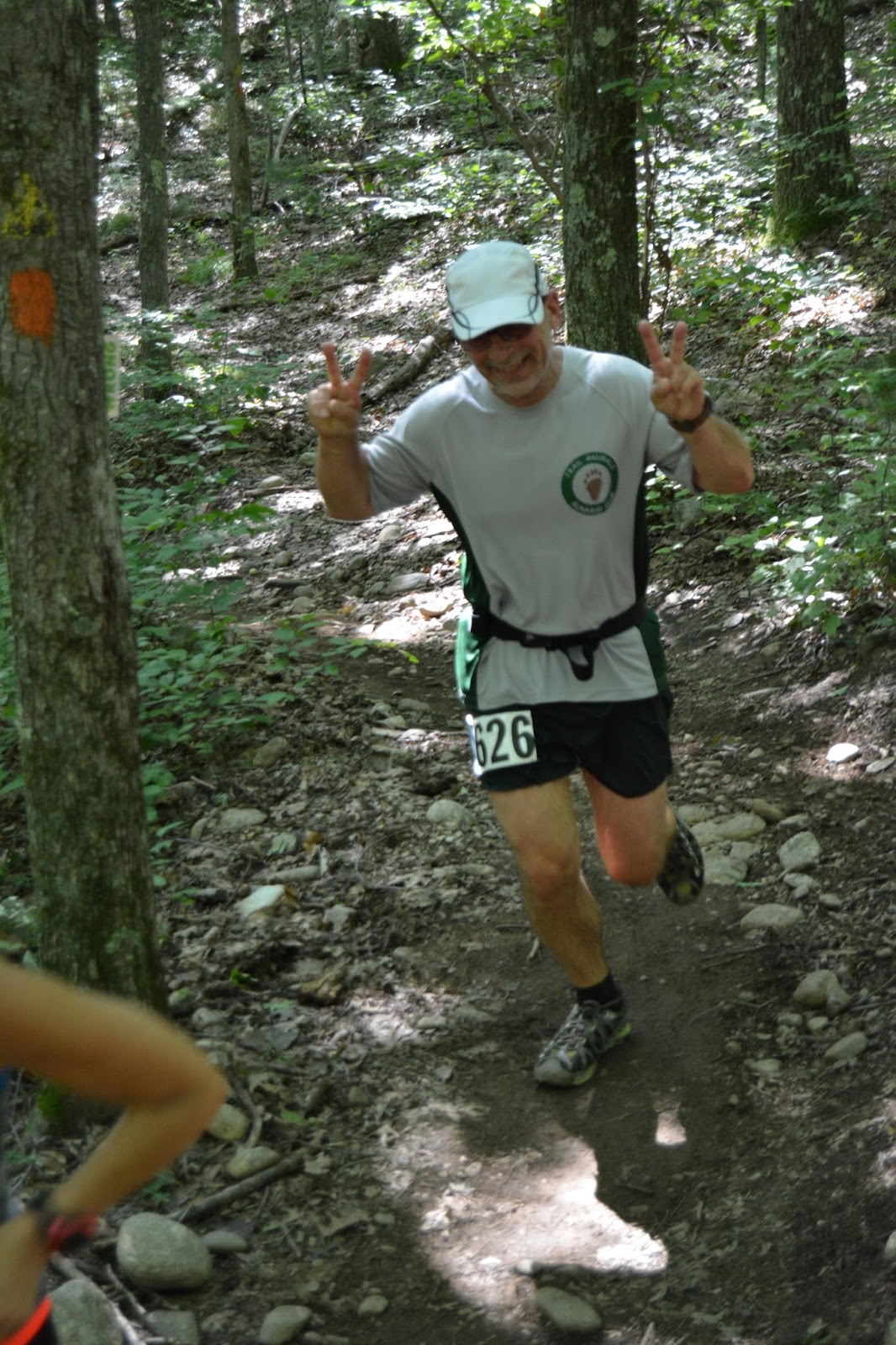
Instead, I headed to nearby Middlesex Fells Reservation to run a loop or two on the eight mile Skyline Trail. I'm registered to run the TARC Winter Ultra in one week which is a 32 and 40 mile race on this very trail. What better preparation could there be than to get familiar with the terrain before race day?  I haven't run in the Fells since 2009 when I completed three loops of the Skyline Trail with my friends KZ and Michelle. I was looking forward to running someplace other than Lynn Woods where I do most of my training runs. I would soon remember why I have avoided the Fells all these years!

I had a difficult time on the technical terrain and my running time for the loop was 30 to 40 minutes slower than what I ran back in 2009. Sure, I'm older, slower and more cautious now but that's a ridiculous time loss for an eight mile run. Needless to say I didn't go out for a second loop. Now, I'm wondering if I should skip the upcoming race. Given my slow time on the race course and my lack of any real training, it seems pointless to toe the starting line this weekend.

Then again, I could always add to my growing list of DNFs!

View of the Boston skyline from Pine Hill.

A closer look.

Wright Tower on Pine Hill.

A distant view of North Reservoir from Winthrop Hill.

North Reservoir pumping station perhaps?

Great Blue Hill on the horizon about 20 miles to the south.

Standing on the bank of North Reservoir.

Decisions, decisions....

Friday, November 18, 2016

Nougat Trail Race Report - The Hardest Race You've Never Heard Of

Anyone familiar with the sport of ultra running has heard of the "The Barkley". It's considered one of the toughest 100 mile races in the world. Perhaps THE toughest. Runners of The Barkley must navigate five loops of the unmarked course, bushwhack through razor sharp briers and locate hidden books before returning to the finish. It has 59,100 feet of climb (and 59,100 feet of descent), more than any other 100 mile race. Since the race began in 1986, only 14 runners out of about 1000 have finished within the 60 hour cutoff. 

"The Nougat" doesn't have books, briers or significant changes in elevation. The course is also well marked making navigation a piece of cake. So what makes this race so hard? I haven't a clue but in it's seven year history no one has ever finished. NO ONE! Surely, this makes "The Nougat" the most difficult race in the world. :)

I went to The Nougat without any hope of finishing the 100 kilometer distance. I've only been running twice a week, averaging about 12 miles total. Even with this low mileage training I thought I had a shot at finishing 50K which meant completing five 10 mile loops (correction: 3 loops. Why make this more difficult than it has to be?). How optimistic of me. And maybe I would have if my mind was in the right place. It wasn't.

When I arrived for the 7 am start it was in the twenties but the strong wind made it feel even colder. I was fine with that. I love cold weather running. There was a small group of runners already gathered at the starting area. I took a quick look at them and didn't recognize a single person. Suddenly, and for the first time, I felt very disconnected from the ultra running community.  It was a very strange feeling indeed. 

Pre-race photo. I must have been VERY tired because I didn't even notice Jim P. and Norm S. Two people I DO know! (photo by Mike Fitzgerald)

Despite the cold, I decided to run in a shorts and a short-sleeved tee shirt. By the time I had taken off all my outer layers the rest of the race field was already 5 minutes ahead of me. About 200 yards into the race I realized I didn't bring any calories with me for the 10 mile loop. Back to the starting line I went. By the time I was back on course I was 10 minutes behind everyone. This led me to feel even more disconnected from the race. 

The 10 mile loop was a mix of single-track and dirt fire roads. I made good time on the fire roads but my pace slowed considerably on the trails. The single-track had an abundance of rocks and roots covered with a thick layer of leaves. I was worried about twisting an ankle, or worse, so I was very slow and careful on all these sections. In my case, I knew this was the right thing to do, but it really annoyed me knowing I'd become so cautious in the woods.

From the beginning, my mind was not into the race. As the miles clicked by I kept hoping my attitude would change. It didn't. I believe I would have felt differently had I not been running alone the entire time. I really missed my friend Karen not being at the race. We run at the same pace and tend to take it easy over the same type of terrain. By mile eight I knew I would drop out after one loop.

Two miles later I became another casualty of the hardest race you've never heard of.

Monday, October 17, 2016

Sea To Summits Tour - Mid-State Trail Day 2

It was raining and 50 degrees with occasional wind gusts courtesy of Hurricane Matthew. It was a prefect morning to sleep in, or sit at the breakfast table drinking coffee. But I had already asked a friend to join me for a 15 mile run on the Massachusetts Mid-State Trail (MST) and I wasn't about to bail on him. I drove west on Route 2 and hoped the weather would improve as I moved away from the coast. It only got worse. I knew we were in for a long, wet slog.

After spotting a car at the Redemption Rock parking lot in Princeton we drove to Ashburnham and found a small patch of dirt on the side of Route 12 and parked the second car. We ran along the narrow shoulder of the road before reaching the trail head and turning into the woods. From here the trail gained 300 feet of elevation in a half mile which helped to take the damp chill out of me. Once we crested the climb we stayed above 1000 feet for the next three or four miles. The trail was littered with slippery rocks and roots and I was thinking it would take a miracle to keep me from falling today.

Before leaving higher elevation we made a brief stop at Muddy Pond to take in the foggy view. There was a tent pitched next to the Muddy Pond shelter and a backpack hanging inside, but no one in sight. I could tell by the size of the food hang that it was probably a thru-hiker or someone out for a long section hike. It was still fairly early in the morning and the hiker probably decided to sleep in when they heard the sound of steady rain hitting their tent. I know I would have done that.


 Gray sky over Muddy Pond.

 Muddy Pond shelter. I laughed when I saw the bear bag hanging five feet off the ground. It would do nothing to deter a hungry bear from snacking on your food.

After passing under graffiti bridge we missed a turn but found it after wandering around in the rain for a while. Less than a half mile later we missing another turn. Once again Bill and I went in opposite directions in search of an elusive yellow triangle which marked the direction of travel. It took some time but we found the trail again. In both cases the trail markers were placed to high to be easily seen. We had one more mishap later in a gravel pit near Route 2 but it was not because we had missed a turn. This time the turn simply was unmarked. These navigation errors added several minutes and about a mile to the run. 

Much of the MST passes through private property so it's important to stay on the marked trail. Eight miles into the run we came to a fenced in cow pasture. After carefully closing the gate behind us we attempted to follow the trail along the perimeter of the pasture. A couple of cows had other ideas and they blocked our path. Instead of sticking close to the fence we had to cross through cow pasture proper, carefully avoiding the numerous, giant, soupy cow patties while looking over our shoulders for an angry bull. Fortunately, the pasture was only occupied by cows and heifers and most of them were hunkered down due to the miserable weather. A quarter mile later we exited the field unscathed and our shoes free of cow poo.


Most of the cows were lying low and didn't give us a second look.

The trail lost elevation over the next four miles and was generally less technical than the previous eight. That all changed when we began the climb up Crow Hill. It may be called a hill but the climb was long, steep and very technical, requiring rock scrambling at times. It's not something you want to do under wet conditions but we didn't have any choice. Crow Hill is known for its vertical cliffs and is a popular location for rock climbers. At times the trail came within inches of the cliffs and one misstep could have resulted in a long plunge to the ground below. I moved with extreme caution through these sections. 


Bill on the steep, rocky climb up Crow Hill.

On a clear day the views from Crow Hill are spectacular but today there were only low clouds and a gray sky visible. Here are some of the views we missed. Photos below were taken from the web.

 View of Mt. Wachusett to the south-west.

View of Rt. 31 and Crow Hill Pond below.

One of the many vertical cliffs.

Getting off Crow Hill was more challenging than climbing it. We had to make a steep descent of about 250 feet over wet boulders of various sizes and shapes. I took to descending on my butt on more than one occasion. I thought it was the safest option. When my feet finally touched dirt again I thought the climbing was over but I was wrong. We made one last climb of 125 feet over the next half mile before reaching Rt 140 in Princeton and the Redemption Rock parking lot. Whew!


A tough, technical and wet 15 mile section run on the MST with over 3,300 feet of elevation change.

Another section of the MST completed. And I make it without a single fall. Miracle! 

Saturday, September 17, 2016

Sea To Summits Tour - Mid-State Trail Day 1

Since posting my plan two months ago to cover over 300 miles on foot through four New England states I haven't walked or run a single step of the route. I just couldn't motivate myself to do it during one of hottest summers on record. Now that cooler weather has arrived I hope to make some progress towards that end. Today's run on the Mid-State Trail was a start. A small one mind you, but still a start.

Since I had previously hiked from the Northern terminus to Mt.Watatic, my plan for today was to start at the Mt. Watatic parking lot in Ashburnham and run to the Wachusetts Village Inn in Westminster, a distance of approximately 15 miles. That changed when my friend Bill M. asked if he could join me. He only had two hours available due to another morning commitment but I was happy to alter my plan. I'd much rather do a two hour out and back with a friend than a 15 mile point to point alone. I already spend way too much time alone.

Although we covered less than nine miles we had to work hard for much of the run, climbing three mountains (twice, since we did and out-and-back) with nearly 1500 feet of vertical gain. I can't recall a whole lot of flat trail on this section of the MST. That's fine with me. I need to start doing more climbing which was painfully obvious as I gasped for air on the return climb up Blueberry Hill. Pass the oxygen please.

Best view of the day from Mt. Hunger. Looking down at Stodge Meadow Pond with Mt. Watatic to the left and the Wapack Range in the distance.

A closer look at the Wapack Range to the right of Mt. Watatic.

Bill leading the way up Mt. Hunger.

A cave in the mountain side.

Today's elevation profile reminds me of ocean waves. Just not as much fun riding these ones!

Happy Trails!

Sunday, September 11, 2016

Maine Lighthouse Ride

This weekend, I participated in the Maine Lighthouse Ride which is the main fundraiser for The Eastern Trail in southern Maine. About 1200 riders had the option to cycle routes ranging from 25 to 100 miles. I haven't been spending as much time on the bike as I would have liked so I picked the 40 mile option. The 40 route would take me though South Portland, Scarborough and Cape Elizabeth with the final 10 miles being the hilliest. So Cruel! I thought the distance was long enough to challenge me and the route also provide an opportunity to see eight of southern Maine's lighthouses. I have to admit I must have not paid close attention to my surroundings and can't recall seeing that many. It was still a great day to be outdoors and it was my longest ride so far. 

Route Map.

40 mile riders lining up for the early morning start.

Civil War fort in Portland Harbor.

Spring Port Lighthouse in Portland

Posing with Bug Light in the background. Can shorts still be called shorts if they are below your knees?

 Taking a break at Ferry Beach in Scarborough.

Looking back at Pine Point Beach, I think.

Approaching Prounts Neck.

Taking another break at Higgins Beach. 

I have to come back here another time for a swim.

Entering Cape Elizabeth.

One of two Lighthouses in Cape Elizabeth.

I believe this is Cape Elizabeth Light West.

One of the many coves along Shore Road.

I know I'm slow but no need to rub it in.

Ride on!


Monday, September 5, 2016

A Run to Remember Eric Sherman

Yesterday morning I made the short drive to Willowdale State Forest in Ipswich to celebrate the life of Eric Sherman. Eric passed unexpectedly last month at the early age of 53. The run was organized by Eric's good friend Mike, and Willowdale was one of Eric's favorite places to train. I'm guessing he really loved the trails here since he lived two hours away and would often meet Mike at 5 am for training runs. It's just an indication how passionate Eric was about running. Thankfully, Mike cut this grumpy old man some slack (and everyone else) and started this run at 7 am. Actually, I had it easy compared to Eric's friend Steve who drove up from New Jersey to join in the run. Good friends do this kind of stuff.

A great turnout for the run. (photo credit: someone's iPhone)

Happy times at the famous(?) Chevy Chevette. (photo credit: Stephanie Cooper)


Mike named a gate after Eric to commemorate his wrong way turn during their first Willowdale run. 

Eric doing what he loved. RIP

A message from Mike:

Eric lived a great life that included a loving family, many great friends and a long-lasting love of the outdoors that he nurtured with his love of hiking and trail running.
Eric became a fixture in the New England Ultramarathoning community over the last 5-6 years of his life with his entry and involvement in a great many races. He became well-known beyond New England thru his podcast "DFL Ultrarunning." His ideas from this medium were to expose a great many people to his sport and to focus on the everyday runners who are drawn to this sport and to be a voice of encouragement to all who choose to participate.
As an active and healthy of a lifestyle as Eric led it did not stop him from being stricken down from heart disease at the very young age of 53. A void that will never be filled has been left with his family, friends and all who knew him. We ask that you consider honoring his memory with a donation that will help the American Heart Association fight heart disease. Thank you. mjs


Donations appreciated.

Peace.

Friday, August 26, 2016

Hodges Hoedown Half Marathon Race Report

Last weekend I drove out to central MA to run my first race of the year. Yeah, I know we're eighth months into 2016 but better late than never, right? As usual, I was totally unprepared for the distance given my training of twice weekly runs totaling 8 - 10 miles. I did have one 10 mile training run under my belt but that was only because I got lost one day in the woods and my planned 7 mile run was unintentionally extended. 


First race bib for 2016. It won't be my last.


View of Hodges Dam near the race start/finish line.

I somehow managed to convince my friend Mary to join me for this race. Mary recently ran a sub-four hour road marathon so I knew I would never be able keep up with her if she was here to race. She decided to stick with me. Thanks Mary! We haven't run together since she broke her ankle on a training run with me and some friends on ice covered trails in the Middlesex Fells several years ago. Ice is one thing we didn't need to concern ourselves with on this day. It was in the mid-eighties and very humid. Just the type of weather that destroys me. Oh,well.


Mary and I at the start. The smile will soon be wiped from my face.

Bringing up the rear at the start of the race. We would later pass several runners only to loose places after missing a turn.

The first four miles of the race were fairly flat with some short, steep climbs but very technical with plenty of rocks and roots to contend with. Miles 5 - 7 were the most difficult and hilly, at one point climbing about 200 feet in less than a mile. The downhills were also challenging with many loose rocks. I chose to move slowly on the descents not wanting to risk a bad fall. The final four miles were mostly flat, smooth trail but I bonked badly with two miles to go and my pace slowed significant. We also missed a clearly marked turn between miles 7 - 8 which added about eight minutes to our time.


The course was not as flat as it appears. There were numerous short, steep climbs.


 Mary led the way throughout the race and set a good pace for me. I would have run slower if I was on my own. I knew the pace was WAY slow for her and told her she could leave me at any time but she stuck with me....until I bonked.  

Peace sign, or me counting the number of times I stubbed a toe in the last mile?

Mary crossing the finish line. She put 11 minutes on me in the final two miles! I'm sure she could have run 30 minutes faster if she ran her own race.

I really had a blast running with Mary despite the weather conditions and my poor fitness.  I already have my sights set on the next race.

Happy Trails!


Friday, July 8, 2016

North-South Trail Trek - Section #6

In May I hiked the last section of the North-South Trail (NST) from George Washington Wildlife Management Area to the northern terminus in Buck Hill Wildlife Management Area on the Rhode Island/Massachusetts border. From there I hiked another two miles on the Mid-State Trail to Wallum Lake in Douglas State Forest where my car was parked. It was an unseasonably warm and humid day and the lack of water and the constant ups and downs in Buck Hill began to wear me down. This was perhaps the best 13 miles of trail on the entire NST. Most of the miles were on single-track trail with only 1.5 miles on a gravel forest road in Buck Hill WMA.

 Bowdish Reservoir in George Washington WMA.

The rocky journey begins.

Striated and split rock.

Some company on the trail.

Barefoot hiking not recommended!

Crossing a boggy section.

 The long and winding road in Buck Hill WMA.
 
It doesn't show well in the photo but these stones were bleached white.

I saw many of these stone cellars on the Mid-State Trail in Douglas State Forest.

Reaching the Rhode Island/Massachusetts border.

More photos of my hike can be viewed here.

Related Posts Plugin for WordPress, Blogger...